How to measure the distance between points or places by using Google Maps
In this blog we will learn How to measure on Google Maps, we’ll show you the steps to get the most important but less-known very useful features of Google Maps- how to find the distance between two points in google maps
How to measure distance with google maps
If you want to know for direction to a place, Google Maps also shows clearly how long a journey will take. If it is needed to know the actual distance between two places. Then, this feature can help you to know that.
Fortunately, by using Google Maps you will be able to find out the distance between any two points on the globe. If you want to measure a certain route, you’ll need to measure it out yourself. It’s very easy to do. Just follow the steps below.
This measurement between two points or several points can be measured by using Google Maps on both the webpage on the desktop version (both Windows OS and macOS), and on also Android smartphones or iOS mobile devices.
Measure distance with Google Maps: Windows and Mac
How to measure distance with google maps
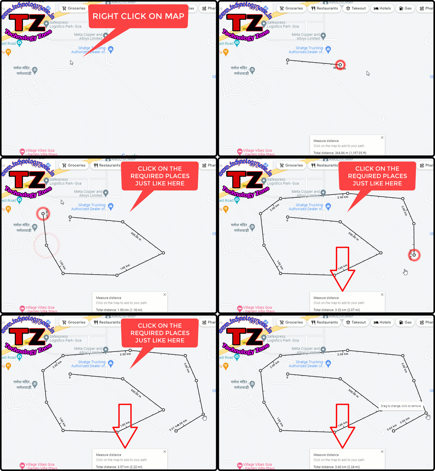
Step 1. After opening Google Maps, right-click on the starting point of the measurement. After that, a menu will appear, click the “Measure Distance” option there.
Step 2. Click on the map anywhere and draw a line joining the starting point and the destination point. The actual distance of the straight line will appear in a box at the bottom of the screen. You can remove the marked points by clicking on them.
Step 3. If you need to measure a more complex route, then click on the line and drag it to the various points. By doing so the total distance will be measured easily. Although, you can draw a route by repeatedly clicking along your required path.
Step 4. For finishing the measurement, click the “X” symbol in the distance measurement box.
How to measure distance in Google Maps on an Android device or iOS
Here we are going to discuss how you can measure distances on an Android device or an iOS device by using the Google Map application. Follow the below steps to do so.
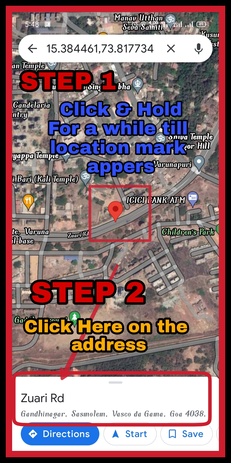
Step 1. Open Google Maps on your smartphone, then tap and hold on to a starting point. After holding it a red marker will appear in a few moments.
Step 2. Tap the name of the place at the bottom of your mobile screen. This could be a specific address, but don’t worry if it’s just a town or city name — tap it anyway.
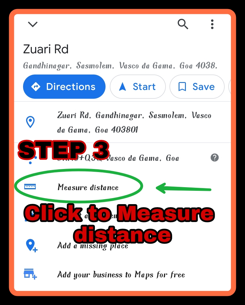
Step 3. Click the “Measure distance” option. After clicking the option, You’ll be returned to the map and the point which you have marked will be surrounded by black crosshairs with a white dot.
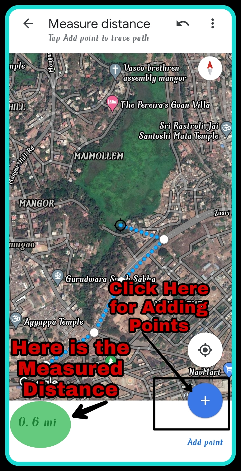
Step 4. Move crosshair points on the map by pressing, holding, and dragging, to the next point you want to measure. After placing the crosshair on the required point, click the blue “+” option. The measured distance of these points will be shown in the bottom-left of the mobile screen.
Step 5. If you want to measure more routes that are not straight in nature, set a new point at every turn you’d need to make. Unlike on PC and Mac, you can’t drag and move an existing line, so map out the route step by step using the “+” option button.
Step 6. You can also undo points by tapping the back arrow symbol at the top-right of the screen.
Many times we don't have a network connection in some places but we need to navigate using Android Google Map. How to do that? It is so simple if you download google maps offline. Please read the step-by-step guide to download Google maps and navigate offline on your Android Smartphone by visiting the below link---
https://www.technologyzone.in/2021/12/how-to-download-google-maps-offline.html





0 Comments
Please do not enter any spam link in the comment box