Export from AutoCAD to Google earth using Global Mapper
What is Global Mapper Software
Steps to export AutoCAD drawing to Google Earth by using Global Mapper.
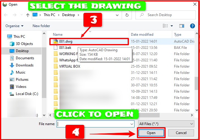
Step 2. Open the "Global Mapper" software & click on the "Open Data Files" there. The same thing is shown in the below image.
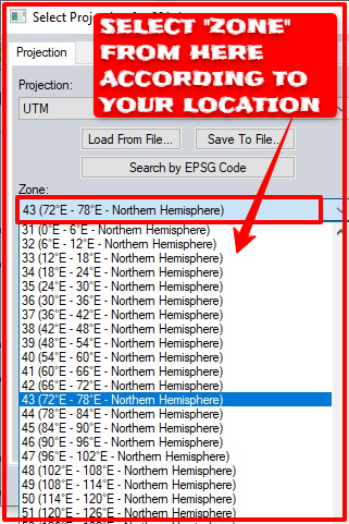
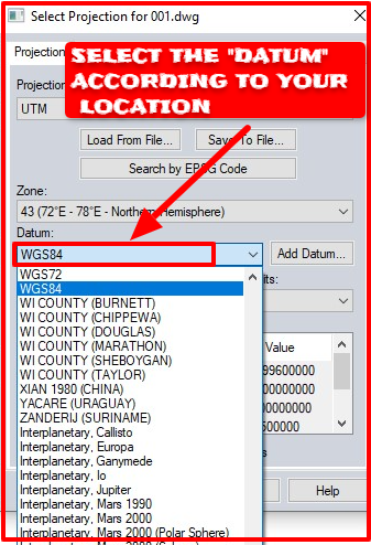
Step 4. Select the "UTM" (Universal Transverse Mercator) option on projection. After that select the "ZONE" from the drop-down option. And select the"DATUM" option next. Select those options according to your location.
Here, is a question, how can you know the "Zone" and "Datum" values in Google Earth?
You can able to know the "Zone" by simply using Google Earth Software. First, open Google Earth and click on the "Add Placemark". Adjust the "Untitled Placemark" pin symbol by moving it to your required location. And a pop-up window will open. You can get the "Zone" and coordinates on that pop-up window. Follow the instruction on the image below---
Also, there is another process to know the "Zone" of your required place. For calculating the UTM zone from Latitude and Longitude visit the link provided here--
https://www.latlong.net/lat-long-utm.html
There you can get the "UTM Easting", "UTM Northing" and "UTM Zone" by typing the latitude and longitude values manually in the box provided. A map is also provided there, you can also click at the exact location for which you need those values. If you click on that map, the latitudes and longitude values will automatically appear in the box provided. You only need to click on the "Convert" button. After clicking the "Convert" button, UTM Easting, UTM Northing, and UTM Zone will be calculated. The values will be shown in their respected box.
You can type the values of latitude and longitude in that box manually by getting the values from Google Earth also. You can also able to get the Latitude & Longitude from UTM Easting, UTM Northing from many android apps also.
Step 5. Click on the "FILE" menu for exporting it to the "KML/KMZ" options.
Step 6. Click on the "EXPORT" menu, and then click the "EXPORT VECTOR / LIDAR FORMAT".
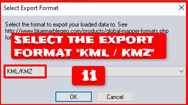
Step 7. Select the "EXPORT" format, as "KML/KMZ" from the drop-down option. There are several options available here. But, you need to choose the "KML/KMZ" format as it is supported by Google Earth Software.
Step 8. Select all things as the picture shown below. And select these options from the menu,
- "Draw 3D Lines on Terrain Surface"
- "Draw 3D Areas on Terrain Surface"
- "Draw 3D Points on Terrain Surface"
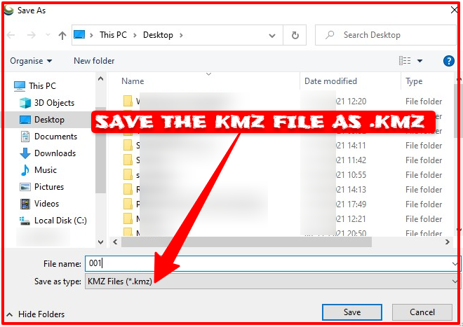
Step 9. After that, click on the "OK" option. Then, the below option will be opened. Save the file in "KMZ" format in any preferred location on your computer.
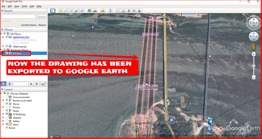
Step 10. Open the saved file in Google Earth by double-clicking on the KMZ file. After the opening, it will show you the exact location on Google Earth. You can check if the drawing is placed in the actual place or somewhere else. After verifying the location, you can share that KMZ file with your client or with your superior by email or any method. And they can open this file if they have the Google Earth Software installed in their system. This file also can be opened on an Android Smartphone, if Google Earth Software is installed on it.
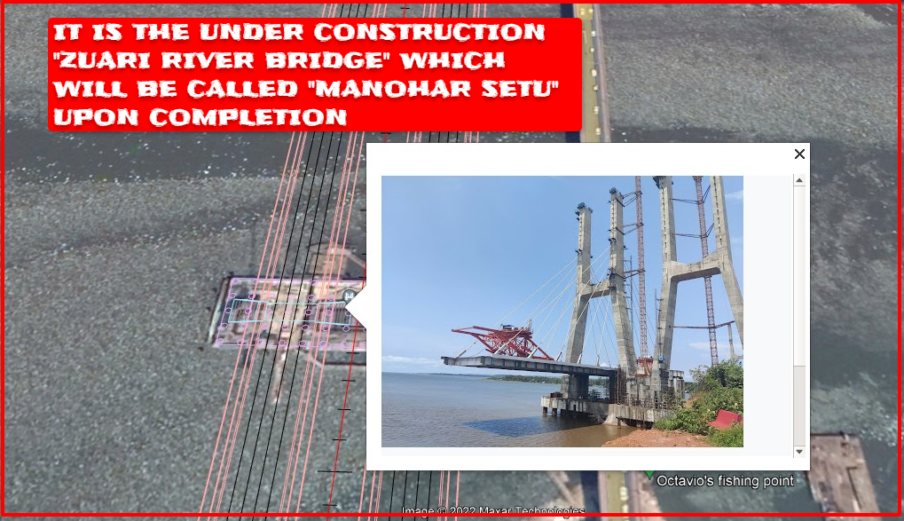
The drawing that has been exported to Google Earth is the under-construction "Zuari River Bridge". This bridge is proposed to be called "Manohar Setu" upon completion. This bridge will be named "Manohar Setu" after former Chief Minister of Goa and former Minister of Defence Manohar Parrikar.










0 Comments
Please do not enter any spam link in the comment box